29 August 2014
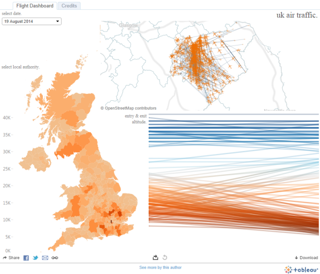
As somebody who’s always fascinated by the possibilities & potential of combining mapping and data visualisation knowing somebody who has some fun geo-data leads to some interesting discussions. Knowing somebody who works for the popular European airline Easyjet leads to hours spent thinking of all the possibilities.In one of our more recent discussions Paul Chapman told me:'Britain has the most crowded airspace in Europe. In July there are typically 30,000 which overfly European airspace with one in four of these flying over the UK. The total distance flown by these aircraft is 25 million nautical miles, enough to go to the moon and back 104 times or around the Earth 998 times. The company NATS are constantly working with airports and airlines to improve STAR and SIDs (Standard Arrival Routes, Standard Instrument Departures) to improve congestion and help to manage the noise and pollution implications over the UK. There is currently a trial in Stanstead of a different departure routing and EasyJet have recently changed their departure route at Gatwick to avoid overflying local villages.'So this leads to the immediate question, just how bad is air traffic around airports as compared to other regions in the UK? Is it possible to map routes and count flights per local authority?This is where Paul’s friends at PlaneFinder.net and my developing Alteryx skills start to bear fruit. The guys at PlaneFinder who track the location of flights around the world gave us API access, Alteryx server was setup to grab the API data every minute and then geotag each plane based on its location over the UK. The data is then brought into Tableau and the results can be seen below. Click the screenshot to explore the viz: So what did I find out? Well it turns out my hometown of York is underneath the quietest skies in the UK, you could call it the eye of the storm. It’s no surprise that the local authorities in the south of England which contain Heathrow, Stanstead, Luton and Gatwick are the busiest but the areas to the North West of London are also very crowded thanks to the flight corridor to these airports and to the rest of Europe.Want to explore the data further? Select a date in the top left & select an area on the map.This post was originally posted on Tableau Public
 So what did I find out? Well it turns out my hometown of York is underneath the quietest skies in the UK, you could call it the eye of the storm. It’s no surprise that the local authorities in the south of England which contain Heathrow, Stanstead, Luton and Gatwick are the busiest but the areas to the North West of London are also very crowded thanks to the flight corridor to these airports and to the rest of Europe.Want to explore the data further? Select a date in the top left & select an area on the map.This post was originally posted on Tableau Public