

19 October 2016
Tableau's annual conference #DATA16 in Austin Texas is nearly upon us. This year 15,000 data lovers are expected to take over downtown Austin inhabiting almost all Hotels & Restaurants for 4 days of pure data geekery. The official venues hosting sessions are spread across eight different locations including an entire convention centre. It's so big it's advertised as a Campus!But this creates a complexity for attendees. How do you plot your way through the 566 different activities on offer? I mean obviously you'll want to be at Christian Chabot's keynote on the Tableau Vision, you just can't miss Devs on Stage which this year is exhibiting the latest and greatest features of Tableau to come in it's very own keynote slot and of course who would want to miss Bill Nye 'The Science Guy'. But what about the 563 others? Do you sacrifice one session to get across town for the other? You you drop out early to avoid the queue? Or is your next venue closer than you'd expect so you can stick around for the Q&A?While I'm at it I'm going to shamelessly plug my own session There's Always REST for the Wicked: Integrating with Tableau Server It's all about people who wouldn't normally code making use of the server REST API. Tableau have classified it as an 'advanced' topic, it's really not. My goal is to make the REST API accessible to everyone. I've even created a tool to help you write the code. Come see what I mean, you won't regret it.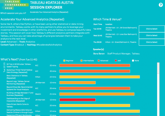 Well actually wait...let's take a step back.First I needed the session data. When I started I don't think it was available to just download from the TC site so I directed ParseHub at the conference site to scrape all the session info for me. Then I cleaned it in Alteryx (workflow looks a bit like this if you're interested?)
 Notice how I'm writing out to a Google Sheet, I've made this public so anybody can use it (the link's at the end of the post so you'll have to read on). What I love about Alteryx & Google Sheets is I can run ParseHub again should the schedule change and have Alteryx update the GSheet, then anybody making a public viz with that GSheet will be automatically updated. Awesome right!?
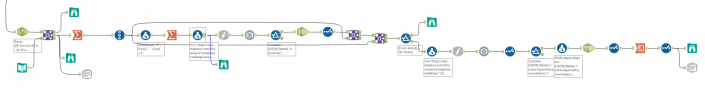 I say finally...not quite. I wanted a platform on which these directions could shine, so I created my own Mapbox map of the TC16 Campus:
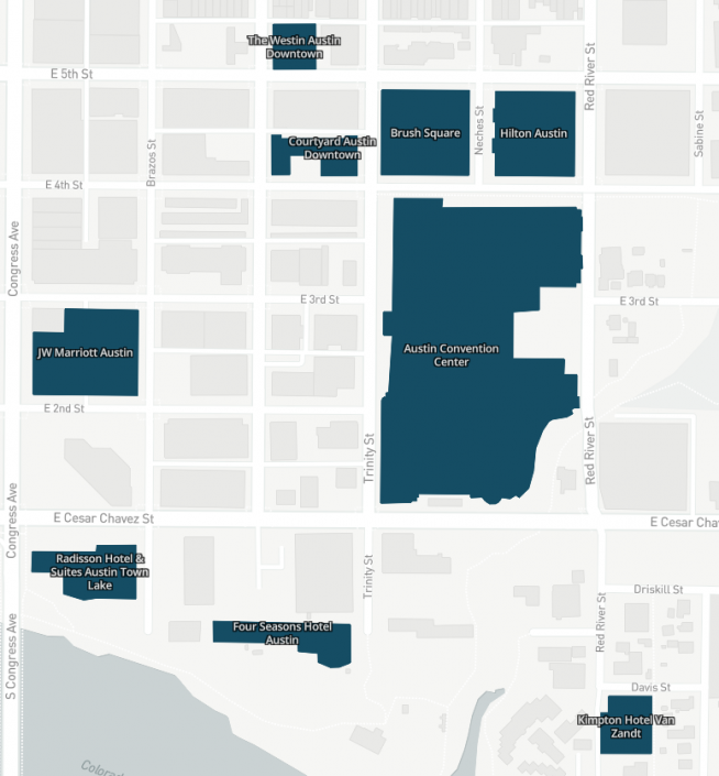 Some of the conference venues are so new I had to update Openstreetmap so they'd show on the map:https://twitter.com/craigbloodworth/status/788121960937062402
It's all about the DATA
(Yes I'm referencing Neil deGrasse Tyson in this title)I wanted to figure out how to best plan my conference using not only the speakers & topics but also what's feasible to get to. So I created a viz:Well actually wait...let's take a step back.First I needed the session data. When I started I don't think it was available to just download from the TC site so I directed ParseHub at the conference site to scrape all the session info for me. Then I cleaned it in Alteryx (workflow looks a bit like this if you're interested?)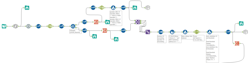 Notice how I'm writing out to a Google Sheet, I've made this public so anybody can use it (the link's at the end of the post so you'll have to read on). What I love about Alteryx & Google Sheets is I can run ParseHub again should the schedule change and have Alteryx update the GSheet, then anybody making a public viz with that GSheet will be automatically updated. Awesome right!?
A Little Help from Mapbox
Finally I did a little data enhancement. Mapbox have an API you can call to return driving, biking and walking directions, no surprise it's called the Directions API and so I pointed Alteryx at this and downloaded all possible combinations you could walk to get from one venue to another (again if you're interested here's what the workflow looks like)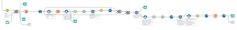 I say finally...not quite. I wanted a platform on which these directions could shine, so I created my own Mapbox map of the TC16 Campus:
 Some of the conference venues are so new I had to update Openstreetmap so they'd show on the map:https://twitter.com/craigbloodworth/status/788121960937062402